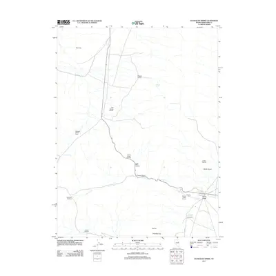
2012 Map of Exchequer Spring
USGS Topo · Published 2012About this map
Cherry Creek serves as the focal point of this high-desert landscape in White Pine County, where the settlement patterns reflect a reliance on scarce water sources and the historic transit through the mountain passes. The map documents the presence of John Salvi's Hot Spring Salvi Ranch and the nearby Madellina Ranch, illustrating the ranching heritage of the Egan Range foothills. Topographic details highlight the strategic importance of high-altitude crossings like Cherry Creek Summit and Overland Summit, which have historically facilitated movement across this basin and range terrain. Evidence of the region's extractive past is found in Lead Mine Canyon, while numerous natural water sources, including Exchequer Spring, Carlson Spring, and Flint Spring, are scattered throughout the canyons and basins, such as Johnson Spring Basin. Peaks like Wide West Peak and Bull Hill anchor the southern elevations, overlooking the dendritic drainage of Cherry Creek Canyon.
Find a feature on this map
28 named features on this map. Tap any name to fly to it.
Don’t see what you’re looking for? This feature index may not catch every label — zoom into the map to look around manually.
Map Details
Editions of this 2012 Exchequer Spring Map
This is the sole edition of this map. No revisions or reprints were ever made.
Other maps of this area

1955 · Elko
USGS Topo · 1:250,000

1956 · Ely
USGS Topo · 1:250,000

1958 · Elko
USGS Topo · 1:250,000

1959 · Ely
USGS Topo · 1:250,000

1962 · Elko
USGS Topo · 1:250,000

1963 · Ely
USGS Topo · 1:250,000

1965 · Elko
USGS Topo · 1:250,000

1982 · Ninemile Well
USGS Topo · 1:24,000

1982 · Borchert Spring
USGS Topo · 1:24,000

1982 · Exchequer Spring
USGS Topo · 1:24,000