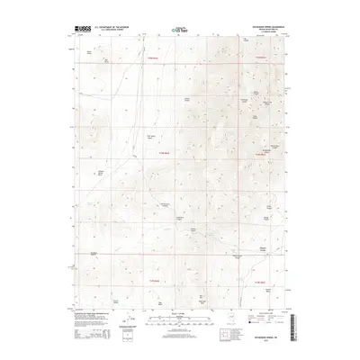
2015 Map of Exchequer Spring
USGS Topo · Published 2015About this map
Cherry Creek sits at the eastern edge of the high mountain terrain where the Steptoe Valley meets the foothills. This area is defined by sharp elevation shifts and numerous water sources that were vital to regional mining and ranching, such as John Salvis Hot Spring and Exchequer Spring. The landscape is carved by an extensive network of drainages including Cherry Creek Canyon and Barton Canyon, which cut through the Cherry Creek Range. Historical transit routes are evident in the passage through Overland Summit and along Egan Canyon RD. The presence of Lead Mine Canyon points to the area's mineral prospects, while landmarks like Wide West Peak and Bull Hill dominate the southern skyline. This survey provides a clear look at how the topography dictated the placement of early settlements and the winding paths of county roads like CR-25 and CR-19.
Find a feature on this map
43 named features on this map. Tap any name to fly to it.
Don’t see what you’re looking for? This feature index may not catch every label — zoom into the map to look around manually.
Map Details
Editions of this 2015 Exchequer Spring Map
This is the sole edition of this map. No revisions or reprints were ever made.
Other maps of this area

1955 · Elko
USGS Topo · 1:250,000

1956 · Ely
USGS Topo · 1:250,000

1958 · Elko
USGS Topo · 1:250,000

1959 · Ely
USGS Topo · 1:250,000

1962 · Elko
USGS Topo · 1:250,000

1963 · Ely
USGS Topo · 1:250,000

1965 · Elko
USGS Topo · 1:250,000

1982 · Ninemile Well
USGS Topo · 1:24,000

1982 · Borchert Spring
USGS Topo · 1:24,000

1982 · Exchequer Spring
USGS Topo · 1:24,000