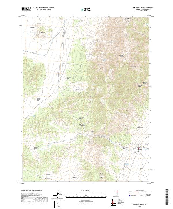
2021 Map of Exchequer Spring
USGS Topo · Published 2021About this map
Cherry Creek sits at the eastern foot of the Cherry Creek Range, serving as a focal point for this high-desert landscape in White Pine County. The topography is defined by sharp elevation shifts between the Steptoe Valley and the Butte Valley, connected by transit points like Overland Summit and Cherry Creek Summit. The naming of Lead Mine Canyon hints at the region's mineral history, while numerous water sources such as Exchequer Spring, Carlson Spring, and Flint Spring underscore the importance of reliable water in this arid environment. The map records a complex network of canyons, including Exchequer Canyon and Silver Canyon, which cut through the mountains towards the valley floors. Lower-elevation landmarks like Egan Basin and the John Salvis Hot Spring contrast with the high peaks of the range, including Wide West Peak and Bull Hill, illustrating the varied terrain that has historically challenged travelers and miners alike.
Find a feature on this map
41 named features on this map. Tap any name to fly to it.
Don’t see what you’re looking for? This feature index may not catch every label — zoom into the map to look around manually.
Map Details
Editions of this 2021 Exchequer Spring Map
This is the sole edition of this map. No revisions or reprints were ever made.
Other maps of this area

1955 · Elko
USGS Topo · 1:250,000

1956 · Ely
USGS Topo · 1:250,000

1958 · Elko
USGS Topo · 1:250,000

1959 · Ely
USGS Topo · 1:250,000

1962 · Elko
USGS Topo · 1:250,000

1963 · Ely
USGS Topo · 1:250,000

1965 · Elko
USGS Topo · 1:250,000

1982 · Ninemile Well
USGS Topo · 1:24,000

1982 · Borchert Spring
USGS Topo · 1:24,000

1982 · Exchequer Spring
USGS Topo · 1:24,000