
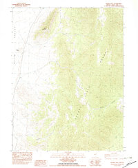
1982 Map of Exchequer Spring
USGS Topo · Published 1982About this map
Cherry Creek Range and the surrounding high-desert basins are defined by a high concentration of silver and tungsten mining operations as they appeared in the early 1980s. The landscape is dotted with named claims including the Exchequer Mine, Chance Mine, and Teacup Mine, clustered largely within the steep drainages of Exchequer Canyon and El Rey Canyon. Evidence of earlier settlement is found at Niptown (Site) and a small Cem near the mouth of the canyon, while agricultural activity persists at the Madellina Ranch and Salvi Ranch in the adjacent Steptoe Valley. The map details a network of springs, such as Exchequer Spring and Carlson Spring, which were vital for both the mining camps and the cattle operations that shared this part of White Pine County. High-altitude crossings like Cherry Creek Summit and Overland Summit connect the disparate valleys through this high-relief terrain.
Find a feature on this map
41 named features on this map. Tap any name to fly to it.
Don’t see what you’re looking for? This feature index may not catch every label — zoom into the map to look around manually.
Map Details
Editions of this 1982 Exchequer Spring Map
This is the sole edition of this map. No revisions or reprints were ever made.
Other maps of this area

1955 · Elko
USGS Topo · 1:250,000

1956 · Ely
USGS Topo · 1:250,000

1958 · Elko
USGS Topo · 1:250,000

1959 · Ely
USGS Topo · 1:250,000

1962 · Elko
USGS Topo · 1:250,000

1963 · Ely
USGS Topo · 1:250,000

1965 · Elko
USGS Topo · 1:250,000

1982 · Ninemile Well
USGS Topo · 1:24,000

1982 · Borchert Spring
USGS Topo · 1:24,000
1982 · Franks Well
USGS Topo · 1:24,000