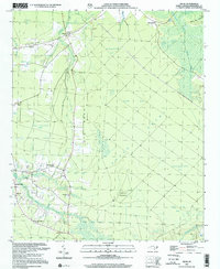
2002 Map of Exum
USGS Topo · Published 2002About this map
Exum and Makatoka anchor this rural landscape in Brunswick County, where the transition between pine flatlands and low-lying wetlands defines the character of the community. The map reveals a high concentration of country churches that serve as the focal points for local neighborhoods, including St Matthew Ch, Trinity Ch, and Zion Ch. Genealogists will find particular value in the identification of family-named burial grounds like Griffin Cem and Milligan Cem, often situated near small watercourses like Mill Branch.
Find a feature on this map
40 named features on this map. Tap any name to fly to it.
Don’t see what you’re looking for? This feature index may not catch every label — zoom into the map to look around manually.
Map Details
Editions of this 2002 Exum Map
This is the sole edition of this map. No revisions or reprints were ever made.
Other maps of this area

1942 · Juniper Creek
USGS Topo · 1:24,000

1943 · Calabash
USGS Topo · 1:31,680

1943 · Freeland
USGS Topo · 1:24,000

1943 · Honey Island
USGS Topo · 1:24,000

1943 · Holden Beach
USGS Topo · 1:24,000

1943 · Exum
USGS Topo · 1:24,000

1943 · Supply
USGS Topo · 1:24,000

1943 · Shallotte
USGS Topo · 1:24,000

1944 · Supply
USGS Topo · 1:31,680

1944 · Shallotte
USGS Topo · 1:31,680