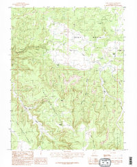
1985 Map of Fable Valley
USGS Topo · Published 1985About this map
Beef Basin and the adjacent Dark Canyon Plateau define this high desert landscape as it appeared during the mid-1980s. This region of San Juan County is characterized by a complex network of drainage systems, including Gypsum Canyon and Ruin Canyon, which cut through the limestone and sandstone layers of the Colorado Plateau. The map reveals a reliance on vital water sources in this arid environment, marking several essential points such as Homewater Spring, Stanley Spring, and Moki Spring.
Find a feature on this map
20 named features on this map. Tap any name to fly to it.
Don’t see what you’re looking for? This feature index may not catch every label — zoom into the map to look around manually.
Map Details
Editions of this 1985 Fable Valley Map
2 editions found
Other maps of this area

1885 · San Rafael
USGS Topo · 1:250,000

1885 · La Sal
USGS Topo · 1:250,000

1886 · Henry Mountains
USGS Topo · 1:250,000

1886 · Abajo
USGS Topo · 1:250,000

1892 · Abajo
USGS Topo · 1:250,000

1892 · Henry Mountains
USGS Topo · 1:250,000

1893 · Abajo
USGS Topo · 1:250,000

1935 · Elk Ridge
USGS Topo · 1:96,000

1940 · Elk Ridge
USGS Topo · 1:125,000

1952 · Mouth of Dark Canyon
USGS Topo · 1:62,500