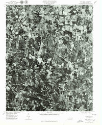
1977 Map of Fair Grove
USGS Topo · Published 1979About this map
Fair Grove and the southern fringes of Thomasville dominate this 1970s orthophotoquad, which uses rectified aerial imagery to reveal the precise physical footprint of Davidson County during a period of suburban expansion. The transition from industrial corridors to rural woodlots is visible in the development patterns surrounding Glen Anna and Johnsontown, where residential streets began to carve through the Piedmont landscape. Water features like Wheatmore Pond and the Little Uwharrie River provide geographic anchors for the rolling terrain. This specialized survey is particularly useful for local historians and land use researchers, as it captures the exact locations of structures and cleared acreage at Gordontown before decades of modern infill altered the local topography.
Find a feature on this map
7 named features on this map. Tap any name to fly to it.
Don’t see what you’re looking for? This feature index may not catch every label — zoom into the map to look around manually.
Map Details
Editions of this 1977 Fair Grove Map
This is the sole edition of this map. No revisions or reprints were ever made.
Other maps of this area

1949 · Denton NW
USGS Topo · 1:24,000

1949 · Eller
USGS Topo · 1:24,000

1949 · High Point West
USGS Topo · 1:24,000

1950 · High Point East
USGS Topo · 1:24,000

1950 · Lexington East
USGS Topo · 1:24,000

1951 · Lexington East
USGS Topo · 1:24,000

1951 · High Point East
USGS Topo · 1:24,000

1951 · Fair Grove
USGS Topo · 1:24,000

1953 · Raleigh
USGS Topo · 1:250,000

1953 · Charlotte
USGS Topo · 1:250,000