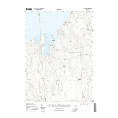
2016 Map of Fair Haven
USGS Topo · Published 2016About this map
Lake Ontario borders the northern edge of this Lake Plain landscape, where the shoreline is defined by the deep inlets of Little Sodus Bay and Blind Sodus Bay. These waters, protected by points such as Sabin Point and Eldridges Point, historically served as vital harbors for the lake trade. Inland, the terrain is shaped by distinct drumlins and glacial features, including The Ridge and several prominent bluffs like McIntyres Bluff and Sitts Bluff.
Find a feature on this map
114 named features on this map. Tap any name to fly to it.
Don’t see what you’re looking for? This feature index may not catch every label — zoom into the map to look around manually.
Map Details
Editions of this 2016 Fair Haven Map
This is the sole edition of this map. No revisions or reprints were ever made.
Other maps of this area

1900 · Oswego
USGS Topo · 1:62,500

1902 · Sodus Bay
USGS Topo · 1:62,500

1902 · Clyde
USGS Topo · 1:62,500

1902 · Weedsport
USGS Topo · 1:62,500

1943 · Oswego West
USGS Topo · 1:31,680

1943 · Cato
USGS Topo · 1:31,680

1943 · Hannibal
USGS Topo · 1:31,680

1943 · Fair Haven
USGS Topo · 1:31,680

1943 · Wolcott
USGS Topo · 1:31,680
1943 · Red Creek
USGS Topo · 1:31,680