
1943 Map of Fair Haven
USGS Topo · Published 1943About this map
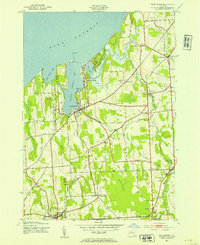
Little Sodus Bay and Blind Sodus Bay dominate the northern shoreline along Lake Ontario, where the Fair Haven Beach State Park meets the water. During this wartime era, the region maintained a dense network of rural infrastructure, including numerous schoolhouses like School No 18 and School No 17. The rail-based economy is evident at Sterling Junction and Sterling Station, where the Lehigh Valley line facilitated transport through the orchards and scattered woodlots of Cayuga and Wayne Counties. Local family history is preserved in small burial grounds such as Phillips Cem and Livingston Cem Mc Arthur Cem. The landscape transitions from the marshy lowlands of The Pond and Juniper Pond to the defined elevations of Juniper Hill and Gulf Hill, illustrating the complex drainage patterns of Sterling Creek as it flows toward the lake.
Find a feature on this map
53 named features on this map. Tap any name to fly to it.
Don’t see what you’re looking for? This feature index may not catch every label — zoom into the map to look around manually.
Map Details
Editions of this 1943 Fair Haven Map
2 editions found
Other maps of this area

1900 · Oswego
USGS Topo · 1:62,500

1902 · Sodus Bay
USGS Topo · 1:62,500

1902 · Clyde
USGS Topo · 1:62,500

1902 · Weedsport
USGS Topo · 1:62,500

1943 · Oswego West
USGS Topo · 1:31,680

1943 · Cato
USGS Topo · 1:31,680

1943 · Hannibal
USGS Topo · 1:31,680

1943 · Wolcott
USGS Topo · 1:31,680
1943 · Red Creek
USGS Topo · 1:31,680
1943 · North Wolcott
USGS Topo · 1:31,680