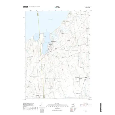
2019 Map of Fair Haven
USGS Topo · Published 2019About this map
Lake Ontario defines the northern coastline of this region, where the distinct glacial geology of the Lake Ontario Plain is evident in features like McIntyres Bluff and Sitts Bluff. The shoreline is heavily articulated by Little Sodus Bay and Blind Sodus Bay, providing natural harbors that supported the development of North Fair Haven and Fair Haven. Further inland, the landscape is a series of north-south drumlins and ridges, such as The Ridge and Wilde Hill, which dictate the drainage patterns of Sterling Valley Creek and Sterling Creek. Local genealogy and settlement history are well-represented by numerous family-named landmarks and burial grounds, including the Livingston Cem, McArthur Cem, and Forscutt Cem. The southern portion of the map shows the village of Red Creek and the small hamlet of Martville, connected to the wider region by the H & N RR rail corridor.
Find a feature on this map
99 named features on this map. Tap any name to fly to it.
Don’t see what you’re looking for? This feature index may not catch every label — zoom into the map to look around manually.
Map Details
Editions of this 2019 Fair Haven Map
This is the sole edition of this map. No revisions or reprints were ever made.
Other maps of this area

1900 · Oswego
USGS Topo · 1:62,500

1902 · Sodus Bay
USGS Topo · 1:62,500

1902 · Clyde
USGS Topo · 1:62,500

1902 · Weedsport
USGS Topo · 1:62,500

1943 · Oswego West
USGS Topo · 1:31,680

1943 · Cato
USGS Topo · 1:31,680

1943 · Hannibal
USGS Topo · 1:31,680

1943 · Fair Haven
USGS Topo · 1:31,680

1943 · Wolcott
USGS Topo · 1:31,680
1943 · Red Creek
USGS Topo · 1:31,680