2023 Map of Fair Haven
USGS Topo · Published 2023About this map
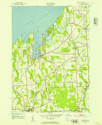
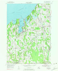
Lake Ontario shapes the northern edge of this coastal landscape, where the sheltered waters of Little Sodus Bay and Blind Sodus Bay provide a distinct harbor geography. The village of Fair Haven serves as a central hub, flanked by the residential clusters of North Fair Haven and the more inland agricultural settlements of Sterling and Sterling Valley. The terrain is defined by dramatic shoreline features like McIntyres Bluff and The Bluffs, while numerous smaller water bodies such as The Pond and Pond Hundred dot the lowlands between the glacial ridges.
Find a feature on this map
120 named features on this map. Tap any name to fly to it.
Don’t see what you’re looking for? This feature index may not catch every label — zoom into the map to look around manually.
Map Details
Editions of this 2023 Fair Haven Map
This is the sole edition of this map. No revisions or reprints were ever made.
Historical Maps of North Fair Haven Through Time
3 maps found