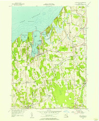
1954 Map of Fair Haven
USGS Topo · Published 1956About this map
The shoreline of Lake Ontario defines this coastal landscape, where the waters of Little Sodus Bay and Blind Sodus Bay indent the northern edge of Cayuga and Wayne counties. The village of Fair Haven sits as a central hub, connected to the waterfront recreation at Fair Haven Beach State Park and the specialized transit of the Marine Railway. To the east and south, the terrain transitions into a patchwork of rural crossroads and farming hamlets including Sterling, McKnight Corners, and Fintches Corners.
Find a feature on this map
71 named features on this map. Tap any name to fly to it.
Don’t see what you’re looking for? This feature index may not catch every label — zoom into the map to look around manually.
Map Details
Editions of this 1954 Fair Haven Map
Other maps of this area

1900 · Oswego
USGS Topo · 1:62,500

1902 · Sodus Bay
USGS Topo · 1:62,500

1902 · Clyde
USGS Topo · 1:62,500

1902 · Weedsport
USGS Topo · 1:62,500

1943 · Oswego West
USGS Topo · 1:31,680

1943 · Cato
USGS Topo · 1:31,680

1943 · Hannibal
USGS Topo · 1:31,680

1943 · Fair Haven
USGS Topo · 1:31,680

1943 · Wolcott
USGS Topo · 1:31,680
1943 · Red Creek
USGS Topo · 1:31,680