Old Maps of Wayne County, New York
Explore 80 old maps of Wayne County, spanning from 1899 to today. These high-resolution historic maps reveal how streets, neighborhoods, landmarks, and natural features evolved over time — perfect for genealogy, metal detecting, research, and local history exploration.
What you can do with these maps:
- See how Wayne County changed over time: Compare historical maps to modern-day views to trace roads, homesites, rail lines & more.
- View detailed metadata: Each map includes creators, publishers, year, scale, and archive source.
- Overlay maps with satellite & LiDAR: Visualize the past alongside modern tools to explore terrain & human change.
- Trusted historical sources: Maps sourced from the USGS, Library of Congress, and other archives.
- Access maps your way: View online, download high-res files, or order prints for personal or research use.
Start exploring old maps of Wayne County to uncover forgotten places, hidden landmarks, and the deep history beneath your feet.
Wayne County, NY maps
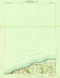
(80)- 1899 Map of Palmyra, 1956 Print
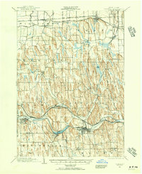 1899 Palmyra1956 Print · USGSCovers Wayne County, including Farmington, Arcadia, and other nearby areas2 unique versions available
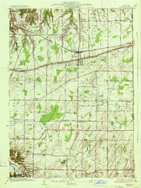
 - 1900 Map of Macedon
 1900 Macedon1900 Print · USGSCovers Wayne County, including Perinton, Webster, and other nearby areas8 unique versions available
 - 1900 Map of Oswego
 1900 Oswego1900 Print · USGSCovers Wayne County, including Oswego, Oswego, and other nearby areas8 unique versions available
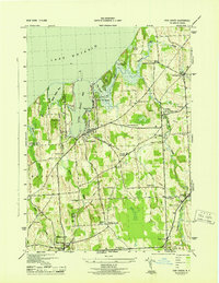
 - 1902 Map of Sodus Bay
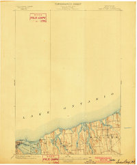 1902 Sodus Bay1902 Print · USGSCovers Wayne County, including Sodus, Wolcott, and other nearby areas7 unique versions available
 - 1902 Map of Pultneyville
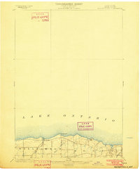 1902 Pultneyville1902 Print · USGSCovers Wayne County, including Sodus, Williamson, and other nearby areas5 unique versions available
 - 1902 Map of Clyde
 1902 Clyde1902 Print · USGSCovers Wayne County, including Sodus, Phelps, and other nearby areas8 unique versions available
 - 1902 Map of Weedsport
 1902 Weedsport1902 Print · USGSCovers Wayne County, including Brutus, Wolcott, and other nearby areas10 unique versions available
 - 1902 Map of Palmyra
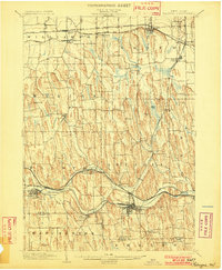 1902 Palmyra1902 Print · USGSCovers Wayne County, including Farmington, Arcadia, and other nearby areas7 unique versions available
 - 1932 Map of Webster
 1932 Webster1932 Print · USGSCovers Wayne County, including Webster, Penfield, and other nearby areas
 - 1934 Map of Ninemile Point
 1934 Ninemile Point1934 Print · USGSCovers Wayne County, including Webster, Ontario, and other nearby areas2 unique versions available
 - 1934 Map of Webster
 1934 Webster1934 Print · USGSCovers Wayne County, including Webster, Penfield, and other nearby areas3 unique versions available
 - 1942 Map of Ontario
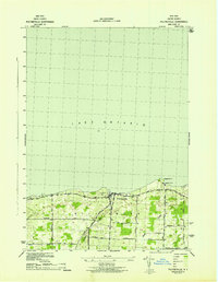
 1942 Ontario1942 Print · USGSCovers Wayne County, including Penfield, Ontario, and other nearby areas
 - 1942 Map of Pultneyville
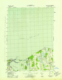
 1942 Pultneyville1942 Print · USGSCovers Wayne County, including Sodus, Williamson, and other nearby areas
 - 1943 Map of Lyons
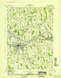
 1943 Lyons1943 Print · USGSCovers Wayne County, including Phelps, Lyons, and other nearby areas
 - 1943 Map of Montezuma
 1943 Montezuma1943 Print · USGSCovers Wayne County, including Mentz, Throop, and other nearby areas
 - 1943 Map of Williamson
 1943 Williamson1943 Print · USGSCovers Wayne County, including Arcadia, Sodus, and other nearby areas
 - 1943 Map of Sodus Point
 1943 Sodus Point1943 Print · USGSCovers Wayne County, including Sodus, Huron, and other nearby areas
 - 1943 Map of Savannah
 1943 Savannah1943 Print · USGSCovers Wayne County, including Galen, Clyde, and other nearby areas
 - 1943 Map of Sodus
 1943 Sodus1943 Print · USGSCovers Wayne County, including Arcadia, Sodus, and other nearby areas
 - 1943 Map of Fair Haven
 1943 Fair Haven1943 Print · USGSCovers Wayne County, including Wolcott, Sterling, and other nearby areas2 unique versions available
 - 1943 Map of Wolcott
 1943 Wolcott1943 Print · USGSCovers Wayne County, including Galen, Wolcott, and other nearby areas
 - 1943 Map of Newark
 1943 Newark1943 Print · USGSCovers Wayne County, including Arcadia, Newark, and other nearby areas
 - 1943 Map of Rose
 1943 Rose1943 Print · USGSCovers Wayne County, including Sodus, Lyons, and other nearby areas
 - 1943 Map of Red Creek
 1943 Red Creek1943 Print · USGSCovers Wayne County, including Wolcott, Sterling, and other nearby areas
 - 1943 Map of North Wolcott
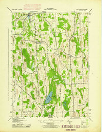
 1943 North Wolcott1943 Print · USGSCovers Wayne County, including Wolcott, Huron, and other nearby areas
Showing maps 1-25 of 80
Top cities of Wayne County
- Arcadia historical maps
- Ontario historical maps
- Macedon historical maps
- Walworth historical maps
- Sodus historical maps
- Palmyra historical maps
See more
Frequently asked questions
- What are the different types of historical maps available for Wayne County?
- What is the oldest map of Wayne County?
- Where can I purchase historical maps of Wayne County for my home or office?
- Where can I download high-res historical maps of Wayne County?
- Are there historical topographic maps available for Wayne County?
- Is there historical aerial imagery available for Wayne County?
- Where are historical maps of Wayne County sourced from?