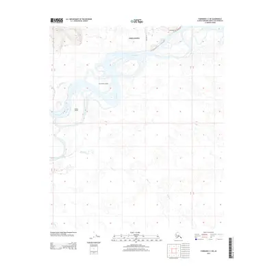
2013 Map of Fairbanks C-3 NE
USGS Topo · Published 2013About this map
Chena Ridge rises above a complex network of waterways southwest of Fairbanks in this 2013 survey. The landscape is defined by the braided channels of the Tanana River, which encircle significant landmasses such as Sam Charley Island and Hadley Island. This map illustrates the intersection of high ground and river bottomlands, where the north-south transition from the ridge to the river basin creates a series of marshes and smaller tributaries like Willow Cr and Sevenmile Slough. Human presence is minimal and concentrated on the northern upland, marked by the Rosie Creek Trl and Kallenberg Rd. The geography shown reflects the dynamic nature of Alaskan interior rivers, where shifting silt and water levels constantly reshape the islands and sloughs along the primary river corridor.
Find a feature on this map
13 named features on this map. Tap any name to fly to it.
Don’t see what you’re looking for? This feature index may not catch every label — zoom into the map to look around manually.
Map Details
Editions of this 2013 Fairbanks C-3 NE Map
This is the sole edition of this map. No revisions or reprints were ever made.
Other maps of this area

1949 · Fairbanks D-2
USGS Topo · 1:62,500

1949 · Fairbanks D-3
USGS Topo · 1:63,360

1949 · Fairbanks C-2
USGS Topo · 1:63,360

1950 · Fairbanks
USGS Topo · 1:250,000

1950 · Fairbanks C-3
USGS Topo · 1:63,360

1950 · Fairbanks D-3
USGS Topo · 1:63,360

1951 · Fairbanks
USGS Topo · 1:250,000

1952 · Fairbanks C-2
USGS Topo · 1:63,360

1952 · Fairbanks D-2
USGS Topo · 1:63,360

1952 · Fairbanks D-3
USGS Topo · 1:63,360