Loading...
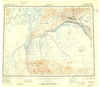
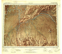
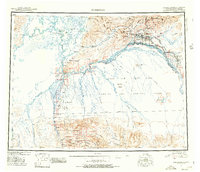
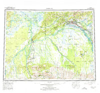
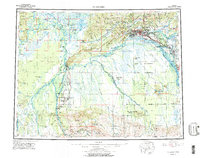
Loading map...1951 Map of Fairbanks
USGS Topo · Published 1951About this map
Fairbanks and its surrounding river valleys appear during a period of significant military and infrastructure development in the mid-twentieth century. The Alaska Railroad serves as a primary transit corridor, connecting the settlements of Nenana and Browne while crossing the massive Tanana River and Nenana River. The landscape is defined by its extensive waterways, including the Tolovana River and the complex Sawmill Slough, which frame the lowlands near Minto and the Minto Lakes.
Find a feature on this map
50 named features on this map. Tap any name to fly to it.
Don’t see what you’re looking for? This feature index may not catch every label — zoom into the map to look around manually.
Map Details
Date Portrayed1951
Date Published1951
PublisherU.S. Geological Survey
Map TypeTopographic
Scale1:250,000
Physical Dimensions26.7 x 23 inches
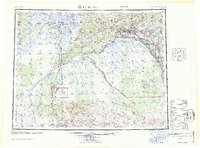
Editions of this 1951 Fairbanks Map
2 editions found
Historical Maps of Fairbanks Through Time
5 maps found
Featured Locations
Source Details
SourceU.S. Geological Survey
CopyrightPublic Domain