Loading...
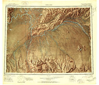
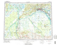
Loading map...1951 Map of Fairbanks
USGS Topo · Published 1951About this map
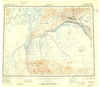
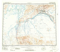
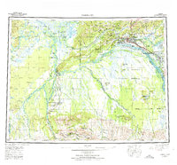
Fairbanks serves as the regional anchor on the Tanana River during the early Cold War era, showing a landscape defined by significant military and transportation infrastructure. Large military tracts, including the Ladd Air Force Base and an extensive Bombing and Gunnery Range, dominate the terrain south of the river. The corridor of the Alaska Railroad connects key river points and settlements like Nenana and Dunbar, while the Richardson Highway extends southeast from the city.
Find a feature on this map
114 named features on this map. Tap any name to fly to it.
Don’t see what you’re looking for? This feature index may not catch every label — zoom into the map to look around manually.
Map Details
Date Portrayed1951
Date Published1951
PublisherU.S. Geological Survey
Map TypeTopographic
Scale1:250,000
Physical Dimensions26.7 x 23 inches
Editions of this 1951 Fairbanks Map
2 editions found
Historical Maps of Fairbanks Through Time
5 maps found
Featured Locations
Source Details
SourceU.S. Geological Survey
CopyrightPublic Domain