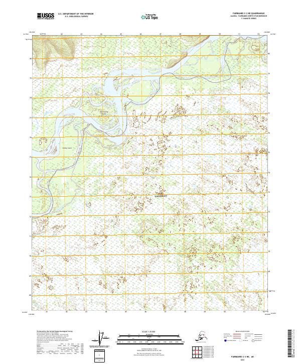
2021 Map of Fairbanks C-3 NE
USGS Topo · Published 2021About this map
Tanana River dominates this interior Alaska landscape, carving a braided path through the marshlands of the Fairbanks North Star region. The waterway surrounds substantial landmasses including Sam Charley Island and Hadley Island, while slow-moving side channels like Sevenmile Slough illustrate the ever-shifting hydrology of the river basin. The terrain is defined by a dense network of wetlands and small tributaries, notably Willow Creek and Rosie Cr, which feed into the primary river system. This 2021 update reflects the contemporary state of these riparian environments, tracing the intricate boundaries of public land surveys like t2s r3w and t2s r4w across an unpopulated wilderness where the natural movement of water is the primary architect of the land.
Find a feature on this map
13 named features on this map. Tap any name to fly to it.
Don’t see what you’re looking for? This feature index may not catch every label — zoom into the map to look around manually.
Map Details
Editions of this 2021 Fairbanks C-3 NE Map
This is the sole edition of this map. No revisions or reprints were ever made.
Other maps of this area

1949 · Fairbanks D-2
USGS Topo · 1:62,500

1949 · Fairbanks D-3
USGS Topo · 1:63,360

1949 · Fairbanks C-2
USGS Topo · 1:63,360

1950 · Fairbanks
USGS Topo · 1:250,000

1950 · Fairbanks C-3
USGS Topo · 1:63,360

1950 · Fairbanks D-3
USGS Topo · 1:63,360

1951 · Fairbanks
USGS Topo · 1:250,000

1952 · Fairbanks C-2
USGS Topo · 1:63,360

1952 · Fairbanks D-2
USGS Topo · 1:63,360

1952 · Fairbanks D-3
USGS Topo · 1:63,360