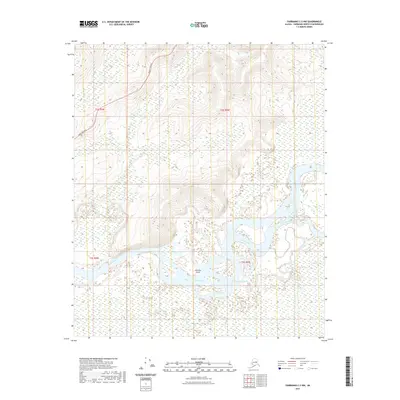
2021 Map of Fairbanks C-3 NW
USGS Topo · Published 2021About this map
The Tanana River dominates this interior Alaska landscape, weaving a complex network of braided channels and side-water features south of the hills. Large landmasses like Whiskey Island are defined by the shifting course of the main river and the adjacent Sevenmile Slough. This fluvial environment is characterized by vast wetlands and seasonal watercourses, including Hot Slough and Bonanza Cr, which drain the higher ground to the north. Transportation through this remote section of the Fairbanks North Star Borough is anchored by the Parks Highway, which skirts the northern foothills. The map provides a clear look at the township and range divisions, such as t2s r4w and t3s r5w, illustrating the intersection of modern infrastructure with the state's wilderness river systems.
Find a feature on this map
10 named features on this map. Tap any name to fly to it.
Don’t see what you’re looking for? This feature index may not catch every label — zoom into the map to look around manually.
Map Details
Editions of this 2021 Fairbanks C-3 NW Map
This is the sole edition of this map. No revisions or reprints were ever made.
Other maps of this area

1949 · Fairbanks D-3
USGS Topo · 1:63,360

1949 · Fairbanks D-4
USGS Topo · 1:63,360

1950 · Fairbanks
USGS Topo · 1:250,000

1950 · Fairbanks C-3
USGS Topo · 1:63,360

1950 · Fairbanks C-4
USGS Topo · 1:63,360

1950 · Fairbanks D-3
USGS Topo · 1:63,360

1951 · Fairbanks
USGS Topo · 1:250,000

1952 · Fairbanks C-4
USGS Topo · 1:63,360

1952 · Fairbanks D-3
USGS Topo · 1:63,360

1952 · Fairbanks D-4
USGS Topo · 1:63,360