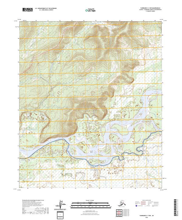
2024 Map of Fairbanks C-3 NW
USGS Topo · Published 2024About this map
Fort Wainwright occupies the southern reaches of this landscape, marking a significant military presence where the terrain meets the complex hydrology of the Tanana River. This 2024 survey illustrates the intricate network of waterways defining the Interior Alaska environment, including the prominent Whiskey Island and the meandering paths of Hot Slough and Sevenmile Slough. To the north, the Parks Highway cuts across the upland terrain, providing a vital transportation artery through the hills above the river valley. The map details the drainage patterns of Bonanza Creek and Crooked Creek, showcasing how these smaller tributaries feed into the larger glacial river system. This modern edition serves as a precise record of the current topography and civil boundaries, such as t2s r4w, in a region where the shifting river channels and forest-covered hills converge.
Find a feature on this map
12 named features on this map. Tap any name to fly to it.
Don’t see what you’re looking for? This feature index may not catch every label — zoom into the map to look around manually.
Map Details
Editions of this 2024 Fairbanks C-3 NW Map
This is the sole edition of this map. No revisions or reprints were ever made.
Other maps of this area

1949 · Fairbanks D-3
USGS Topo · 1:63,360

1949 · Fairbanks D-4
USGS Topo · 1:63,360

1950 · Fairbanks
USGS Topo · 1:250,000

1950 · Fairbanks C-3
USGS Topo · 1:63,360

1950 · Fairbanks C-4
USGS Topo · 1:63,360

1950 · Fairbanks D-3
USGS Topo · 1:63,360

1951 · Fairbanks
USGS Topo · 1:250,000

1952 · Fairbanks C-4
USGS Topo · 1:63,360

1952 · Fairbanks D-3
USGS Topo · 1:63,360

1952 · Fairbanks D-4
USGS Topo · 1:63,360