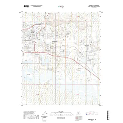
2021 Map of Fairbanks D-2 SE
USGS Topo · Published 2021About this map
Fairbanks serves as the central hub of this modern survey, where the concentrated street grids of neighborhoods like Lemeta, Slaterville, and Hamilton Acres meet the expansive military and aviation footprint of Ladd Army Airfield. The landscape is defined by the braided hydrology of the Tanana River to the south and the Chena River winding through the city center, with the R/W Line Tanana Levee providing a critical boundary between the floodplains and the developed urban core. To the north, the elevation rises sharply toward Birch Hill, which is home to the Birch Hill Cem.
Find a feature on this map
46 named features on this map. Tap any name to fly to it.
Don’t see what you’re looking for? This feature index may not catch every label — zoom into the map to look around manually.
Map Details
Editions of this 2021 Fairbanks D-2 SE Map
This is the sole edition of this map. No revisions or reprints were ever made.
Other maps of this area

1949 · Fairbanks D-1
USGS Topo · 1:62,500

1949 · Fairbanks D-2
USGS Topo · 1:62,500

1949 · Fairbanks C-1
USGS Topo · 1:63,360

1949 · Fairbanks C-2
USGS Topo · 1:63,360

1950 · Fairbanks
USGS Topo · 1:250,000

1950 · Fairbanks C-1
USGS Topo · 1:63,360

1951 · Fairbanks
USGS Topo · 1:250,000

1952 · Fairbanks C-2
USGS Topo · 1:63,360

1952 · Fairbanks D-2
USGS Topo · 1:63,360
1952 · Fairbanks C-1
USGS Topo · 1:63,360
Featured Places
- Fairbanks, AK
- Hamilton Acres, Fairbanks
- Lemeta, Fairbanks
- Slaterville, Fairbanks
- Fairbanks North Star, AK