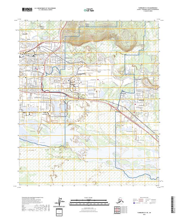
2024 Map of Fairbanks D-2 SE
USGS Topo · Published 2024About this map
The Chena River winds through the heart of this Alaskan corridor, defining the urban and military geography of Fairbanks. This 2024 survey captures the intricate road network of the interior, from the Johansen Expressway to the specialized neighborhoods of Hamilton Acres and Slaterville. To the north, the elevation rises sharply toward Birch Hill, where the Birch Hill Cem overlooks the valley.
Find a feature on this map
43 named features on this map. Tap any name to fly to it.
Don’t see what you’re looking for? This feature index may not catch every label — zoom into the map to look around manually.
Map Details
Editions of this 2024 Fairbanks D-2 SE Map
This is the sole edition of this map. No revisions or reprints were ever made.
Other maps of this area

1949 · Fairbanks D-1
USGS Topo · 1:62,500

1949 · Fairbanks D-2
USGS Topo · 1:62,500

1949 · Fairbanks C-1
USGS Topo · 1:63,360

1949 · Fairbanks C-2
USGS Topo · 1:63,360

1950 · Fairbanks
USGS Topo · 1:250,000

1950 · Fairbanks C-1
USGS Topo · 1:63,360

1951 · Fairbanks
USGS Topo · 1:250,000

1952 · Fairbanks C-2
USGS Topo · 1:63,360

1952 · Fairbanks D-2
USGS Topo · 1:63,360
1952 · Fairbanks C-1
USGS Topo · 1:63,360
Featured Places
- Fairbanks, AK
- Hamilton Acres, Fairbanks
- Lemeta, Fairbanks
- Slaterville, Fairbanks
- Fairbanks North Star, AK