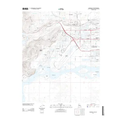
2013 Map of Fairbanks D-2 SW
USGS Topo · Published 2013About this map
Fairbanks and its surrounding northern reach are defined by the braided channels of the Tanana River and the winding Chena River during the early 2010s. The landscape is a mix of dense urban development and vast riverine islands like Loper Island, Morgan Island, and Haines Islands. To the west, the residential expansion onto Chena Ridge and the historic Gold Hill area contrasts with the industrial and transportation hub near Garden Island. This era shows the mature integration of the Alaska Railroad and the massive complex of the University of Alaska Fairbanks overlooking Smith Lake and Ballaine Lake. Significant infrastructure, including the Fairbanks International Airport and the Ruth Burnett Sport Fish Hatchery, highlights the city's role as a regional anchor. Water management and drainage are evident in features such as the Chena Ester Ditch and the sloughs that segment the lower valley floor.
Find a feature on this map
158 named features on this map. Tap any name to fly to it.
Don’t see what you’re looking for? This feature index may not catch every label — zoom into the map to look around manually.
Map Details
Editions of this 2013 Fairbanks D-2 SW Map
This is the sole edition of this map. No revisions or reprints were ever made.
Other maps of this area

1949 · Fairbanks D-2
USGS Topo · 1:62,500

1949 · Fairbanks D-3
USGS Topo · 1:63,360

1949 · Fairbanks C-2
USGS Topo · 1:63,360

1950 · Fairbanks
USGS Topo · 1:250,000

1950 · Fairbanks C-3
USGS Topo · 1:63,360

1950 · Fairbanks D-3
USGS Topo · 1:63,360

1951 · Fairbanks
USGS Topo · 1:250,000

1952 · Fairbanks C-2
USGS Topo · 1:63,360

1952 · Fairbanks D-2
USGS Topo · 1:63,360

1952 · Fairbanks D-3
USGS Topo · 1:63,360