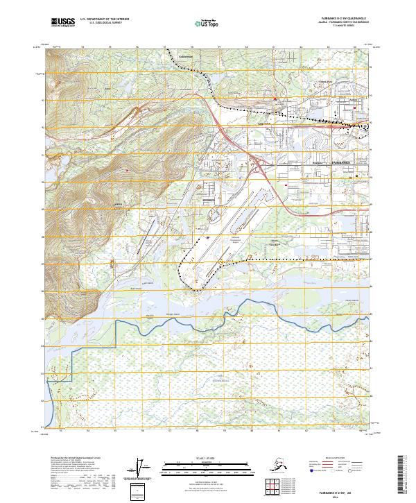
2024 Map of Fairbanks D-2 SW
USGS Topo · Published 2024About this map
The Chena River winds through a landscape defined by the convergence of academic, aviation, and military infrastructure west of Fairbanks. This area is anchored by the University of Alaska Fairbanks campus on Troth Yeddha, overlooking the residential and commercial districts of College, Aurora, and Westgate. The intricate waterways of the Tanana River floodplain dominate the southern half of the map, where Fort Wainwright and numerous islands like Byers Island and Wenrich Island are situated.
Find a feature on this map
223 named features on this map. Tap any name to fly to it.
Don’t see what you’re looking for? This feature index may not catch every label — zoom into the map to look around manually.
Map Details
Editions of this 2024 Fairbanks D-2 SW Map
This is the sole edition of this map. No revisions or reprints were ever made.
Other maps of this area

1949 · Fairbanks D-2
USGS Topo · 1:62,500

1949 · Fairbanks D-3
USGS Topo · 1:63,360

1949 · Fairbanks C-2
USGS Topo · 1:63,360

1950 · Fairbanks
USGS Topo · 1:250,000

1950 · Fairbanks C-3
USGS Topo · 1:63,360

1950 · Fairbanks D-3
USGS Topo · 1:63,360

1951 · Fairbanks
USGS Topo · 1:250,000

1952 · Fairbanks C-2
USGS Topo · 1:63,360

1952 · Fairbanks D-2
USGS Topo · 1:63,360

1952 · Fairbanks D-3
USGS Topo · 1:63,360