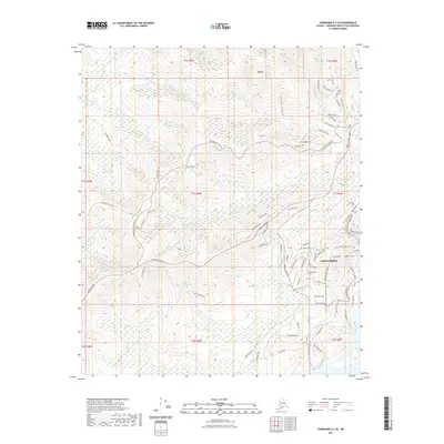
2021 Map of Fairbanks D-3 SE
USGS Topo · Published 2021About this map
Ester serves as the focal point of this interior Alaska survey, where the legacy of early 20th-century mining is still reflected in the contemporary road network and landscape. The settlement is situated at the confluence of several prominent waterways, including Ester Cr and Ready Bullion Cr, with the prominent Chena Ridge rising to the southeast. The area's mineral history is suggested by local thoroughfares such as Gold Lode Road, Quartz Road, and Stone Road, while more established transportation corridors like the Parks Highway and the Old Nenana Highway provide regional connectivity. This 2021 update records the expanding residential footprint around Chena Ridge, where modern subdivisions like Peartree Loop and Sonata Drive now contrast with the older, more isolated routes like the Old Ridge Trail and Eva Creek Trl that wind through Moose Gulch.
Find a feature on this map
89 named features on this map. Tap any name to fly to it.
Don’t see what you’re looking for? This feature index may not catch every label — zoom into the map to look around manually.
Map Details
Editions of this 2021 Fairbanks D-3 SE Map
This is the sole edition of this map. No revisions or reprints were ever made.
Other maps of this area

1949 · Fairbanks D-2
USGS Topo · 1:62,500

1949 · Fairbanks D-3
USGS Topo · 1:63,360

1949 · Fairbanks C-2
USGS Topo · 1:63,360

1950 · Fairbanks
USGS Topo · 1:250,000

1950 · Fairbanks C-3
USGS Topo · 1:63,360

1950 · Fairbanks D-3
USGS Topo · 1:63,360

1951 · Fairbanks
USGS Topo · 1:250,000

1952 · Fairbanks C-2
USGS Topo · 1:63,360

1952 · Fairbanks D-2
USGS Topo · 1:63,360

1952 · Fairbanks D-3
USGS Topo · 1:63,360