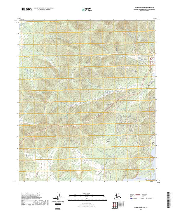
2024 Map of Fairbanks D-3 SE
USGS Topo · Published 2024About this map
Ester sits as a central point of reference in this landscape of interior Alaska, where the legacy of gold mining is etched into the terrain through a network of creeks and ridge-running trails. The map illustrates a transition from the elevated peaks of Chena Ridge and Moose Gulch down toward the broad basin of the Tanana River and the northwestern edges of Fort Wainwright. Transport history is prominent here, shown by the evolution of movement from the Old Ridge Trail and Old Nenana Highway to the modern corridor of the Parks Highway. Residential growth is evident in the clusters of named roads like Azurite Drive and Sapphire Drive northeast of the town center. The drainage patterns of Ready Bullion Creek and Cripple Creek offer fine detail for those tracing the historical hydrography and resource extraction routes of the Fairbanks North Star Borough.
Find a feature on this map
89 named features on this map. Tap any name to fly to it.
Don’t see what you’re looking for? This feature index may not catch every label — zoom into the map to look around manually.
Map Details
Editions of this 2024 Fairbanks D-3 SE Map
This is the sole edition of this map. No revisions or reprints were ever made.
Other maps of this area

1949 · Fairbanks D-2
USGS Topo · 1:62,500

1949 · Fairbanks D-3
USGS Topo · 1:63,360

1949 · Fairbanks C-2
USGS Topo · 1:63,360

1950 · Fairbanks
USGS Topo · 1:250,000

1950 · Fairbanks C-3
USGS Topo · 1:63,360

1950 · Fairbanks D-3
USGS Topo · 1:63,360

1951 · Fairbanks
USGS Topo · 1:250,000

1952 · Fairbanks C-2
USGS Topo · 1:63,360

1952 · Fairbanks D-2
USGS Topo · 1:63,360

1952 · Fairbanks D-3
USGS Topo · 1:63,360