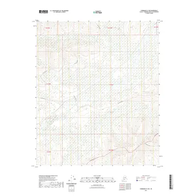
2021 Map of Fairbanks D-3 SW
USGS Topo · Published 2021About this map
Goldstream Cr and its many tributaries, including Cache Cr and Allen Cr, dominate this interior Alaska landscape west of Fairbanks. The topographic data highlights a complex drainage system where Left Fork Cache Cr and Ohio Cr carve through the terrain. Human infrastructure is concentrated along the southern and western corridors, primarily defined by the Parks Highway and secondary access routes such as Standard Creek Road. These thoroughfares provide the primary transit through the region's dense network of ridges and valley bottoms. Near the southern boundary, Bonanza Cr flows through a deep valley, illustrating the characteristic elevation changes of the Tanana Valley foothills. The layout of Cache Creek Road further demonstrates the historical reliance on ridge-top and creek-side trails for navigation through this wilderness area.
Find a feature on this map
16 named features on this map. Tap any name to fly to it.
Don’t see what you’re looking for? This feature index may not catch every label — zoom into the map to look around manually.
Map Details
Editions of this 2021 Fairbanks D-3 SW Map
This is the sole edition of this map. No revisions or reprints were ever made.
Other maps of this area

1949 · Fairbanks D-3
USGS Topo · 1:63,360

1949 · Fairbanks D-4
USGS Topo · 1:63,360

1950 · Fairbanks
USGS Topo · 1:250,000

1950 · Fairbanks C-3
USGS Topo · 1:63,360

1950 · Fairbanks C-4
USGS Topo · 1:63,360

1950 · Fairbanks D-3
USGS Topo · 1:63,360

1951 · Fairbanks
USGS Topo · 1:250,000

1952 · Fairbanks C-4
USGS Topo · 1:63,360

1952 · Fairbanks D-3
USGS Topo · 1:63,360

1952 · Fairbanks D-4
USGS Topo · 1:63,360