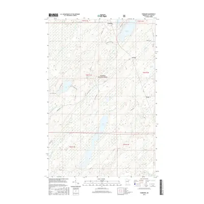
2016 Map of Fairbanks
USGS Topo · Published 2016About this map
Superior National Forest encompasses much of this Saint Louis County landscape, where the headwaters of the Cloquet River and the S Br Whiteface River begin their drainage through a complex of glacial lakes and wetlands. Small settlements like Fairbanks and Hornby appear along established routes such as Townline Road and Fairbanks Road, while industrial activity is noted at the Fairbanks Gravel Pit. The map captures a transition between low-lying riparian areas near Wolf Lake and the higher ground marked by the Ahola Road corridor. Remote access is defined by specialized trails and spurs, including Hagstrom Trl and Breda Spur H, which suggest the area's continued reliance on forestry and natural resource management. Water bodies like Bassett Lake and Otto Lake dominate the northern terrain, feeding a network of creeks including Petrell Creek and Jenkins Cr.
Find a feature on this map
40 named features on this map. Tap any name to fly to it.
Don’t see what you’re looking for? This feature index may not catch every label — zoom into the map to look around manually.
Map Details
Editions of this 2016 Fairbanks Map
This is the sole edition of this map. No revisions or reprints were ever made.
Other maps of this area

1954 · Two Harbors
USGS Topo · 1:250,000

1954 · Hibbing
USGS Topo · 1:250,000

1956 · Pequaywan Lake
USGS Topo · 1:24,000

1956 · King Lake
USGS Topo · 1:24,000

1957 · Two Harbors
USGS Topo · 1:250,000

1957 · Hibbing
USGS Topo · 1:250,000

1957 · Brimson
USGS Topo · 1:62,500

1957 · Markham
USGS Topo · 1:62,500
1957 · Boulder Lake Reservoir NE
USGS Topo · 1:24,000

1958 · Hibbing
USGS Topo · 1:250,000