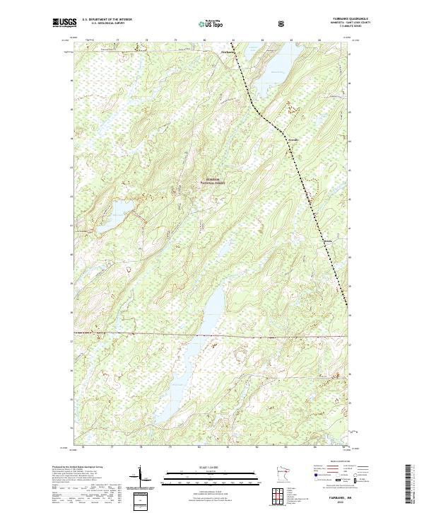
2022 Map of Fairbanks
USGS Topo · Published 2022About this map
Superior National Forest encompasses the vast majority of this Saint Louis County landscape, where timber and water dictate the layout of small settlements like Fairbanks and Hornby. The terrain is defined by a dense network of hydrologic features, including the Cloquet River and its various branches, alongside prominent water bodies like Wolf Lake and Bassett Lake. These watercourses were vital to the early development of the region's resource-based economy, as evidenced by the presence of the Fairbanks Gravel Pit and numerous forest service roads.
Find a feature on this map
35 named features on this map. Tap any name to fly to it.
Don’t see what you’re looking for? This feature index may not catch every label — zoom into the map to look around manually.
Map Details
Editions of this 2022 Fairbanks Map
This is the sole edition of this map. No revisions or reprints were ever made.
Other maps of this area

1954 · Two Harbors
USGS Topo · 1:250,000

1954 · Hibbing
USGS Topo · 1:250,000

1956 · Pequaywan Lake
USGS Topo · 1:24,000

1956 · King Lake
USGS Topo · 1:24,000

1957 · Two Harbors
USGS Topo · 1:250,000

1957 · Hibbing
USGS Topo · 1:250,000

1957 · Brimson
USGS Topo · 1:62,500

1957 · Markham
USGS Topo · 1:62,500
1957 · Boulder Lake Reservoir NE
USGS Topo · 1:24,000

1958 · Hibbing
USGS Topo · 1:250,000