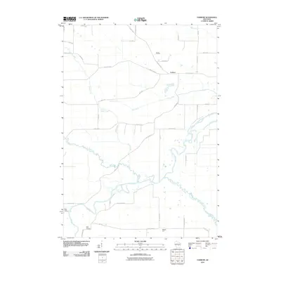
2010 Map of Fairburn
USGS Topo · Published 2010About this map
The confluence of the White River and the Fox River anchors this central Wisconsin landscape, where the flat riverbottoms meet the rising land of Mount Tom. The settlement of Fairburn sits at a crossroads in the northern portion of the map, surrounded by a complex network of agricultural drainage and natural waterways including Sucker Creek and Barnes Creek. The presence of several historic burial grounds, such as Fairburn Cemetery, Black Creek Cemetery, and Saint Marie Cemetery, provides significant data points for genealogists tracing early families in Seneca. The terrain is further defined by the winding course of the Puchyan River as it meanders toward the Fox, reflecting a landscape heavily influenced by both natural glaciation and human-engineered water management via the Town Drain system. This 2010 survey offers a detailed look at the rural road grid, from County Hwy-E to small farm lanes like Chappa Rd.
Find a feature on this map
37 named features on this map. Tap any name to fly to it.
Don’t see what you’re looking for? This feature index may not catch every label — zoom into the map to look around manually.
Map Details
Editions of this 2010 Fairburn Map
This is the sole edition of this map. No revisions or reprints were ever made.
Other maps of this area

1915 · Neshkoro
USGS Topo · 1:48,000

1916 · Ripon
USGS Topo · 1:48,000

1918 · Neshkoro
USGS Topo · 1:62,500

1918 · Ripon
USGS Topo · 1:62,500

1955 · Green Bay
USGS Topo · 1:250,000

1956 · Ripon
USGS Topo · 1:62,500

1957 · Madison
USGS Topo · 1:250,000

1960 · Madison
USGS Topo · 1:250,000

1961 · Poy Sippi
USGS Topo · 1:62,500

1961 · Redgranite
USGS Topo · 1:62,500