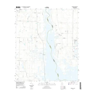
2014 Map of Fairchild
USGS Topo · Published 2014About this map
Lake Seminole dominates the landscape at the meeting point of the Florida-Georgia border, where the Chattahoochee River widens along the Jackson Co and Seminole Co lines. This riverine environment is defined by a dense network of water bodies, including Boram Lake, Sand Lake, and dozens of smaller ponds like Battle Pond and Hettie Pond. The settlement of Fairchild and the residential area of Paradise Acres occupy the higher ground east of the river, while the small communities of Parramore and Haynes lie to the northwest. Genealogists will find a significant concentration of family burial grounds throughout the area, such as Fairchild Cem, Robinson Cem, and Whiddon Cem. The mapping reflects a rural infrastructure of local routes like River Rd and Butler Rd that navigate the marshy terrain and Thompson Pond Ditch.
Find a feature on this map
81 named features on this map. Tap any name to fly to it.
Don’t see what you’re looking for? This feature index may not catch every label — zoom into the map to look around manually.
Map Details
Editions of this 2014 Fairchild Map
This is the sole edition of this map. No revisions or reprints were ever made.
Other maps of this area

1952 · Cypress
USGS Topo · 1:24,000

1952 · Dellwood
USGS Topo · 1:24,000

1952 · Bascom
USGS Topo · 1:24,000

1954 · Steam Mill
USGS Topo · 1:24,000

1954 · Sneads
USGS Topo · 1:24,000

1954 · Desser
USGS Topo · 1:24,000

1954 · Tallahassee
USGS Topo · 1:250,000

1955 · Fairchild
USGS Topo · 1:24,000

1955 · Reynoldsville
USGS Topo · 1:24,000

1955 · Chattahoochee
USGS Topo · 1:24,000