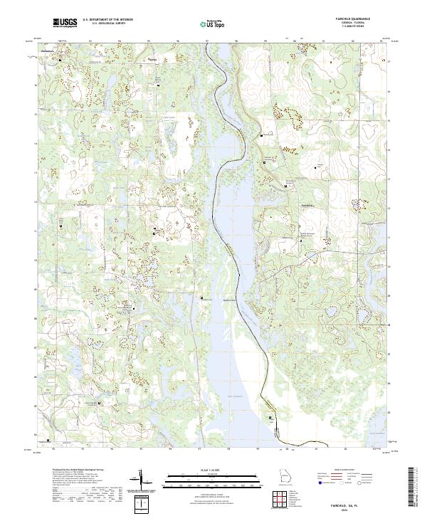
2024 Map of Fairchild
USGS Topo · Published 2024About this map
The Chattahoochee River defines the border between Georgia and Florida in this reach of Seminole County, feeding into the northern waters of Lake Seminole. The landscape is defined by a dense network of inland waters, ranging from Sand Lake and Yarber Pond to Turtle Shell Pond, reflecting the low-lying, wetland-rich nature of the river valley. Settlement is scattered, with nodes of activity at Fairchild and Parramore, connected by a rural road network that includes Welcome Church Rd and Parramore Rd.
Find a feature on this map
64 named features on this map. Tap any name to fly to it.
Don’t see what you’re looking for? This feature index may not catch every label — zoom into the map to look around manually.
Map Details
Editions of this 2024 Fairchild Map
This is the sole edition of this map. No revisions or reprints were ever made.
Other maps of this area

1952 · Cypress
USGS Topo · 1:24,000

1952 · Dellwood
USGS Topo · 1:24,000

1952 · Bascom
USGS Topo · 1:24,000

1954 · Steam Mill
USGS Topo · 1:24,000

1954 · Sneads
USGS Topo · 1:24,000

1954 · Desser
USGS Topo · 1:24,000

1954 · Tallahassee
USGS Topo · 1:250,000

1955 · Fairchild
USGS Topo · 1:24,000

1955 · Reynoldsville
USGS Topo · 1:24,000

1955 · Chattahoochee
USGS Topo · 1:24,000