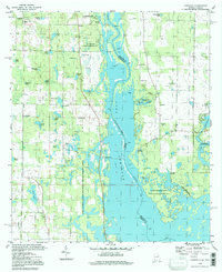
1994 Map of Fairchild
USGS Topo · Published 1998About this map
Lake Seminole dominates this borderland landscape, where the waters of the Chattahoochee and Flint Rivers converge at the Georgia and Florida line. The map captures a transition in land use, showing extensive conservation and recreation areas like Fairchild State Park, Seminole State Park, and the expansive Apalachee State Wildlife Management Area. These protected grounds sit adjacent to older riverfront landmarks such as Butlers Ferry Landing and Parramore Landing, which hint at the region's earlier transportation history before the creation of the reservoir.
Find a feature on this map
53 named features on this map. Tap any name to fly to it.
Don’t see what you’re looking for? This feature index may not catch every label — zoom into the map to look around manually.
Map Details
Editions of this 1994 Fairchild Map
This is the sole edition of this map. No revisions or reprints were ever made.
Other maps of this area

1952 · Cypress
USGS Topo · 1:24,000

1952 · Dellwood
USGS Topo · 1:24,000

1952 · Bascom
USGS Topo · 1:24,000

1954 · Steam Mill
USGS Topo · 1:24,000

1954 · Sneads
USGS Topo · 1:24,000

1954 · Desser
USGS Topo · 1:24,000

1954 · Tallahassee
USGS Topo · 1:250,000

1955 · Fairchild
USGS Topo · 1:24,000

1955 · Reynoldsville
USGS Topo · 1:24,000

1955 · Chattahoochee
USGS Topo · 1:24,000