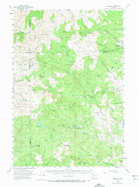
1955 Map of Fairdale
USGS Topo · Published 1973About this map
Fairdale and the surrounding timberlands of the Northern Oregon Coast Range define this 1955 survey. The landscape is a network of ridges and watercourses, where the Tualatin River and North Fork Yamhill River begin their descent toward the Willamette Valley. The presence of Haskins Creek Reservoir and smaller bodies like Meadow Lake and Rainbow Lake highlight the area's role in local water management and recreation during the mid-century. Logging history is evident through numerous named sites such as Camp Five and Camp One, along with the curiously named Neverstill. High-altitude surveillance for fire management is noted by the Trask Mtn Lookout and High Heaven Lookout, which served as vital sentinel points for the surrounding forest. This map also traces the transition from the settlement at Cherry Grove into the deeper reaches of the Tillamook and Washington County lines.
Find a feature on this map
68 named features on this map. Tap any name to fly to it.
Don’t see what you’re looking for? This feature index may not catch every label — zoom into the map to look around manually.
Map Details
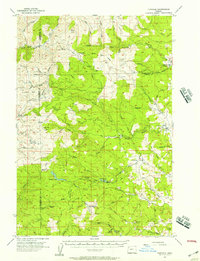
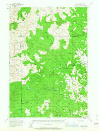
Editions of this 1955 Fairdale Map
3 editions found
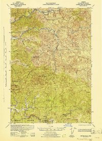
Other maps of this area

1924 · Mc Minnville
USGS Topo · 1:48,000

1926 · Mc Minnville
USGS Topo · 1:62,500

1937 · Enright
USGS Topo · 1:62,500

1940 · McMinnville
USGS Topo · 1:62,500

1941 · Timber
USGS Topo · 1:62,500

1941 · Enright
USGS Topo · 1:62,500

1941 · Gales Creek
USGS Topo · 1:62,500

1941 · Yamhill
USGS Topo · 1:62,500
1942 · Ginger Peak
USGS Topo · 1:62,500

1942 · Sheridan
USGS Topo · 1:62,500