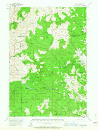
1955 Map of Fairdale
USGS Topo · Published 1963About this map
Steinberg Ridge and Blind Ridge dominate the landscape of the Northern Oregon Coast Range in the mid-1950s, a period when the timber industry and forestry infrastructure defined the local geography. The map documents a network of logging history through locations such as Neverstill (Site), Camp One (Site), and Camp Five (Site), alongside active outposts like Sixteenmile Cabin and the Murphy Guard Sta. Fire prevention and management are evident in the placement of the Trask Mtn Lookout 3423 and High Heaven Lookout.
Find a feature on this map
69 named features on this map. Tap any name to fly to it.
Don’t see what you’re looking for? This feature index may not catch every label — zoom into the map to look around manually.
Map Details
Editions of this 1955 Fairdale Map
3 editions found

Other maps of this area

1924 · Mc Minnville
USGS Topo · 1:48,000

1926 · Mc Minnville
USGS Topo · 1:62,500

1937 · Enright
USGS Topo · 1:62,500

1940 · McMinnville
USGS Topo · 1:62,500

1941 · Timber
USGS Topo · 1:62,500

1941 · Enright
USGS Topo · 1:62,500

1941 · Gales Creek
USGS Topo · 1:62,500

1941 · Yamhill
USGS Topo · 1:62,500

1942 · Ginger Peak
USGS Topo · 1:62,500

1942 · Sheridan
USGS Topo · 1:62,500