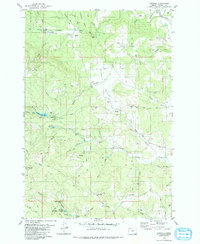
1979 Map of Fairdale
USGS Topo · Published 1980About this map
Fairdale sits at a junction of timber and creek-carved ridges in the Yamhill country during the late 1970s. The landscape is defined by the headwaters of the Yamhill River, where numerous seasonal drainages like Kutch Creek and Moores Valley Creek feed into larger bodies such as Haskins Creek Res and the Carlton Reservoir. This area reflects a mid-century shift toward recreation and forestry management, evident in the presence of Camp Yamhill, Murray Park, and the High Heaven Lookout Tower standing watch over the heights. The inclusion of the Flying M Ranch and its adjacent Landing Strip suggests a remote, rugged locale where private aviation bridged the gap between isolated hill country and the valley below. Local history is further marked by the quiet presence of the Pike Cem and various unnamed family Graves scattered across the upland slopes.
Find a feature on this map
63 named features on this map. Tap any name to fly to it.
Don’t see what you’re looking for? This feature index may not catch every label — zoom into the map to look around manually.
Map Details
Editions of this 1979 Fairdale Map
2 editions found
Other maps of this area

1924 · Mc Minnville
USGS Topo · 1:48,000

1926 · Mc Minnville
USGS Topo · 1:62,500

1940 · McMinnville
USGS Topo · 1:62,500

1941 · Yamhill
USGS Topo · 1:62,500

1942 · Sheridan
USGS Topo · 1:62,500

1942 · Yamhill
USGS Topo · 1:62,500

1942 · Fairdale
USGS Topo · 1:62,500

1948 · Vancouver
USGS Topo · 1:250,000

1950 · Vancouver
USGS Topo · 1:250,000

1950 · Vancouver
USGS Topo · 1:250,000