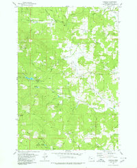
1979 Map of Fairdale
USGS Topo · Published 1980About this map
Fairdale sits at the confluence of the North Yamhill River and Fairchild Creek, serving as a central point for the timber and ranching activities in this corner of Yamhill County. The landscape is defined by its water resources, featuring the Haskins Creek Res and Carlton Reservoir, which are linked by an extensive aqueduct system traversing the hillsides. The terrain rises sharply toward the south at High Heaven Lookout Tower and Ball Bearing Hill, while numerous waterfalls like Baker Creek Falls and Silver Falls mark the descent of mountain streams into the valley. Lodges and camps, including Flying M Ranch, Camp Yamhill, and Rainbow Lodge, suggest a region heavily utilized for outdoor recreation and forestry management during the late 1970s. Traces of local industry are evident in the scattered quarries and borrow pits that supported the network of logging roads and jeep trails throughout Moores Valley.
Find a feature on this map
49 named features on this map. Tap any name to fly to it.
Don’t see what you’re looking for? This feature index may not catch every label — zoom into the map to look around manually.
Map Details
Editions of this 1979 Fairdale Map
2 editions found
Other maps of this area

1924 · Mc Minnville
USGS Topo · 1:48,000

1926 · Mc Minnville
USGS Topo · 1:62,500

1940 · McMinnville
USGS Topo · 1:62,500

1941 · Yamhill
USGS Topo · 1:62,500

1942 · Sheridan
USGS Topo · 1:62,500

1942 · Yamhill
USGS Topo · 1:62,500

1942 · Fairdale
USGS Topo · 1:62,500

1948 · Vancouver
USGS Topo · 1:250,000

1950 · Vancouver
USGS Topo · 1:250,000

1950 · Vancouver
USGS Topo · 1:250,000