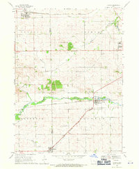
1968 Map of Fairfax
USGS Topo · Published 1971About this map
The town of Fairfax and its surrounding countryside in the late 1960s reveal a landscape defined by the convergence of major rail lines and rural community centers. The Chicago Milwaukee St Paul and Pacific railroad cuts diagonally across the southern half of the sheet, intersecting near Walford, while the Chicago and North Western tracks parallel the course of Prairie Creek. These transportation corridors historically fueled the growth of settlements like Atkins in the north and the western edges of Cedar Rapids in the northeast.
Find a feature on this map
29 named features on this map. Tap any name to fly to it.
Don’t see what you’re looking for? This feature index may not catch every label — zoom into the map to look around manually.
Map Details
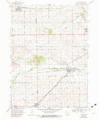
Editions of this 1968 Fairfax Map
2 editions found
Other maps of this area

1887 · Cedar Rapids
USGS Topo · 1:62,500

1888 · Shellsburg
USGS Topo · 1:62,500

1888 · Marion
USGS Topo · 1:62,500

1888 · Amana
USGS Topo · 1:62,500

1889 · Marion
USGS Topo · 1:62,500

1889 · Amana
USGS Topo · 1:62,500

1889 · Shellsburg
USGS Topo · 1:62,500

1891 · Cedar Rapids
USGS Topo · 1:62,500

1899 · Amana
USGS Topo · 1:62,500

1899 · Shellsburg
USGS Topo · 1:62,500