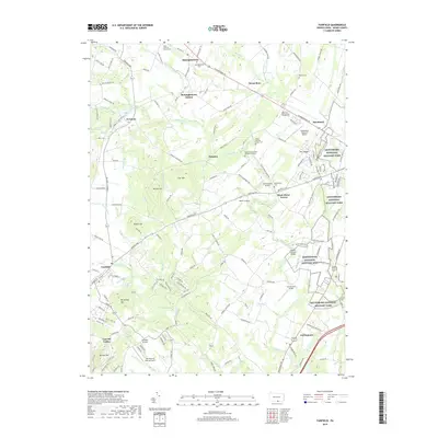
2019 Map of Fairfield
USGS Topo · Published 2019About this map
Gettysburg National Military Park and the Eisenhower National Historic Site anchor the eastern landscape of this modern survey, marking the profound historical significance of the Adams County countryside. The terrain is defined by a series of prominent rises including Herr Ridge, Carr Hill, and Sugar Loaf, with the waters of Marsh Creek and Willoughby Run carving through the valley floors.
Find a feature on this map
159 named features on this map. Tap any name to fly to it.
Don’t see what you’re looking for? This feature index may not catch every label — zoom into the map to look around manually.
Map Details
Editions of this 2019 Fairfield Map
This is the sole edition of this map. No revisions or reprints were ever made.
Other maps of this area

1908 · Gettysburg
USGS Topo · 1:62,500

1909 · Fairfield
USGS Topo · 1:62,500

1911 · Taneytown
USGS Topo · 1:62,500

1911 · Emmitsburg
USGS Topo · 1:62,500

1942 · Gettysburg
USGS Topo · 1:125,000

1943 · Emmitsburg
USGS Topo · 1:62,500

1944 · Gettysburg
USGS Topo · 1:31,680

1944 · Flat Ridge
USGS Topo · 1:31,680
1944 · Blue Ridge Summit
USGS Topo · 1:31,680

1944 · Arendtsville
USGS Topo · 1:31,680