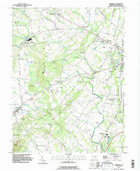
1990 Map of Fairfield
USGS Topo · Published 1995About this map
Gettysburg National Military Park dominates the eastern edge of this landscape, preserving the hallowed ground of the American Civil War as it appeared in 1990. The map details the transition from the structured preservation of the Eisenhower National Historic Site to the rural townships of Franklin and Cumberland. Local heritage is evident in the numerous small family and community burial grounds, such as McClelland Cem and Blacks Cem, which anchor the lineage of the surrounding farmland.
Find a feature on this map
78 named features on this map. Tap any name to fly to it.
Don’t see what you’re looking for? This feature index may not catch every label — zoom into the map to look around manually.
Map Details
Editions of this 1990 Fairfield Map
This is the sole edition of this map. No revisions or reprints were ever made.
Other maps of this area

1908 · Gettysburg
USGS Topo · 1:62,500

1909 · Fairfield
USGS Topo · 1:62,500

1911 · Taneytown
USGS Topo · 1:62,500

1911 · Emmitsburg
USGS Topo · 1:62,500

1942 · Gettysburg
USGS Topo · 1:125,000

1943 · Emmitsburg
USGS Topo · 1:62,500

1944 · Gettysburg
USGS Topo · 1:31,680

1944 · Flat Ridge
USGS Topo · 1:31,680
1944 · Blue Ridge Summit
USGS Topo · 1:31,680

1944 · Arendtsville
USGS Topo · 1:31,680
Featured Places
- Fairfield, PA
- Franklin Township, PA
- Hamiltonban Township, PA
- Cumberland Township, PA
- Liberty Township, PA