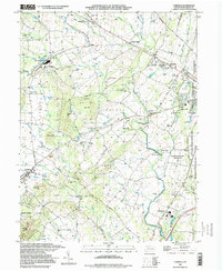
1994 Map of Fairfield
USGS Topo · Published 1998About this map
The western edges of the Gettysburg battlefields meet the rolling agricultural lands of Adams County in this late-century survey. The eastern margin is dominated by Gettysburg National Military Park, where Confederate Avenue and a prominent Lookout Tower overlook the historic ridges. Nearby, the Eisenhower National Historic Site preserves the farm of the 34th President. The landscape is defined by the drainage of Marsh Creek and its many tributaries, including Middle Creek and Willoughby Run.
Find a feature on this map
73 named features on this map. Tap any name to fly to it.
Don’t see what you’re looking for? This feature index may not catch every label — zoom into the map to look around manually.
Map Details
Editions of this 1994 Fairfield Map
This is the sole edition of this map. No revisions or reprints were ever made.
Other maps of this area

1908 · Gettysburg
USGS Topo · 1:62,500

1909 · Fairfield
USGS Topo · 1:62,500

1911 · Taneytown
USGS Topo · 1:62,500

1911 · Emmitsburg
USGS Topo · 1:62,500

1942 · Gettysburg
USGS Topo · 1:125,000

1943 · Emmitsburg
USGS Topo · 1:62,500

1944 · Gettysburg
USGS Topo · 1:31,680

1944 · Flat Ridge
USGS Topo · 1:31,680
1944 · Blue Ridge Summit
USGS Topo · 1:31,680

1944 · Arendtsville
USGS Topo · 1:31,680
Featured Places
- Fairfield, PA
- Franklin Township, PA
- Hamiltonban Township, PA
- Cumberland Township, PA
- Liberty Township, PA