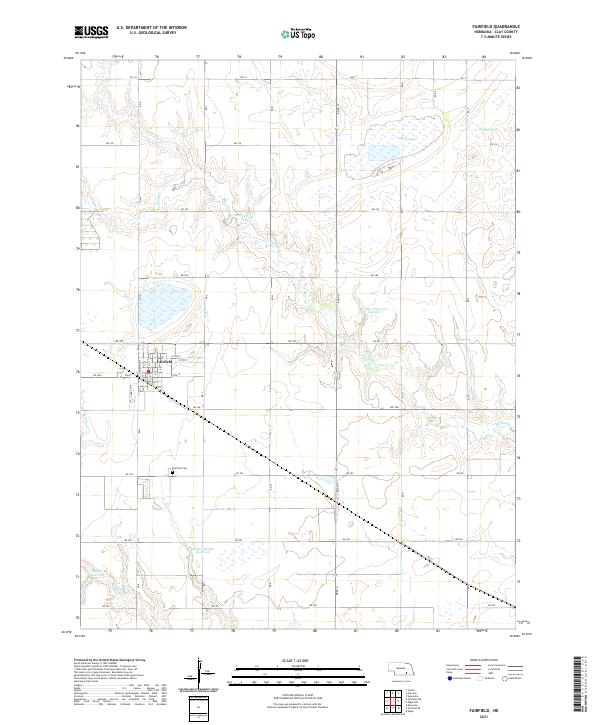
1969 Map of Fairfield
USGS Topo · Published 1971About this map
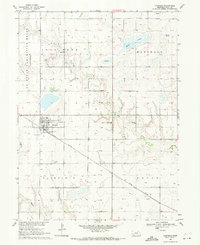
The town of Fairfield serves as the hub of this Clay County landscape, where the Union Pacific railroad cuts a diagonal line through the prairie grid. The map reveals a transition in land use, most notably within the western portion occupied by the U S Naval Ammunition Depot (Abandoned), which dominates several sections with its distinct layout. The hydrology of the region is defined by ephemeral basins and wandering waterways, including the Massie Lagoon and Harms Lagoon, alongside the drainage of Sandy Creek and Buffalo Creek. Local institutions such as the Sandy Creek High Sch and several burial sites like Eller Cem and Fairfield Cem provide clear anchor points for genealogists and local historians tracking family footprints across the townships of Lone Tree, Marshall, and Edgar.
Find a feature on this map
17 named features on this map. Tap any name to fly to it.
Don’t see what you’re looking for? This feature index may not catch every label — zoom into the map to look around manually.
Map Details
Editions of this 1969 Fairfield Map
This is the sole edition of this map. No revisions or reprints were ever made.
Historical Maps of Fairfield Through Time
5 maps found