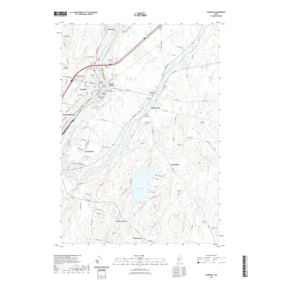
2021 Map of Fairfield
USGS Topo · Published 2021About this map
The Kennebec River serves as the central artery for this region, splitting the landscape as it passes through Fairfield and down toward Waterville. Numerous river islands, including Lily Island, Middle Island, and Libbey Island, mark the channel where the river meets the Sebasticook River at the southern edge of the quadrangle. This area reflects a deep-rooted network of rural crossroads and river-side settlements such as Benton Station and Benton Falls.
Find a feature on this map
114 named features on this map. Tap any name to fly to it.
Don’t see what you’re looking for? This feature index may not catch every label — zoom into the map to look around manually.
Map Details
Editions of this 2021 Fairfield Map
This is the sole edition of this map. No revisions or reprints were ever made.
Other maps of this area

1892 · Waterville
USGS Topo · 1:62,500

1893 · Vassalboro
USGS Topo · 1:62,500

1898 · Vassalboro
USGS Topo · 1:62,500

1916 · Liberty
USGS Topo · 1:62,500

1926 · Burnham
USGS Topo · 1:62,500

1941 · Vassalboro
USGS Topo · 1:62,500

1942 · Liberty
USGS Topo · 1:62,500

1943 · Vassalboro
USGS Topo · 1:62,500

1943 · Waterville
USGS Topo · 1:62,500

1948 · Bangor
USGS Topo · 1:250,000