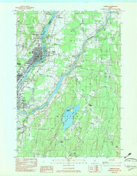
1982 Map of Fairfield
USGS Topo · Published 1983About this map
The Kennebec River corridor defines the industrial and social landscape of this central Maine region in the early 1980s. This survey details the urban centers of Fairfield, Waterville, and Winslow, where the Maine Central railroad lines parallel the river to support local industry. The geography is punctuated by numerous islands like Lily Island and Nutts Island, while the eastern portion of the map transitions into the more rural environments of Benton and Albion.
Find a feature on this map
77 named features on this map. Tap any name to fly to it.
Don’t see what you’re looking for? This feature index may not catch every label — zoom into the map to look around manually.
Map Details
Editions of this 1982 Fairfield Map
2 editions found
Other maps of this area

1892 · Waterville
USGS Topo · 1:62,500

1893 · Vassalboro
USGS Topo · 1:62,500

1898 · Vassalboro
USGS Topo · 1:62,500

1916 · Liberty
USGS Topo · 1:62,500

1926 · Burnham
USGS Topo · 1:62,500

1941 · Vassalboro
USGS Topo · 1:62,500

1942 · Liberty
USGS Topo · 1:62,500

1943 · Vassalboro
USGS Topo · 1:62,500

1943 · Waterville
USGS Topo · 1:62,500

1948 · Bangor
USGS Topo · 1:250,000