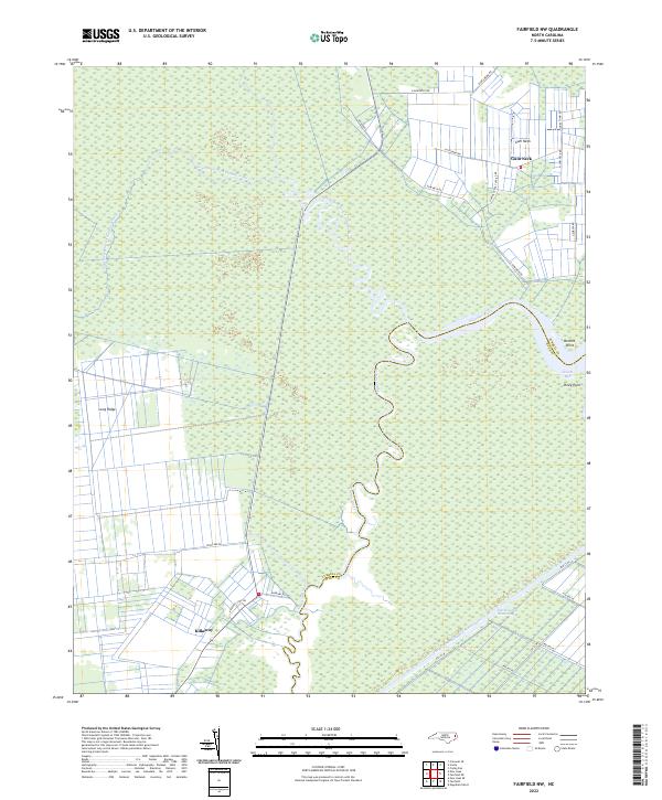
2022 Map of Fairfield NW
USGS Topo · Published 2022About this map
Alligator River and its intricate forks define this coastal landscape, where the Tyrrell Co Hyde Co boundary line cuts through dense wetlands. Small settlements like Gum Neck and Kilkenny are connected by a network of rural roads that navigate the low-lying terrain, including N Gum Neck Rd and Kilkenny Rd. The importance of water-based transportation and regional connectivity is evident in the straight course of the Intracoastal Waterway and the Pungo River-Alligator River Canal in the southern portion of the sheet. Notable land features like Long Ridge and coastal points such as Bonnet Point and Piney Point highlight the subtle elevations and shoreline variations along Scouts Bay.
Find a feature on this map
28 named features on this map. Tap any name to fly to it.
Don’t see what you’re looking for? This feature index may not catch every label — zoom into the map to look around manually.
Map Details
Editions of this 2022 Fairfield NW Map
This is the sole edition of this map. No revisions or reprints were ever made.
Other maps of this area

1943 · Columbia
USGS Topo · 1:125,000

1951 · Engelhard West
USGS Topo · 1:24,000

1951 · Fairfield
USGS Topo · 1:24,000

1951 · New Lake SE
USGS Topo · 1:24,000

1953 · Fairfield NE
USGS Topo · 1:24,000

1953 · Scotia
USGS Topo · 1:24,000

1953 · Frying Pan
USGS Topo · 1:24,000

1953 · Fairfield NW
USGS Topo · 1:24,000

1953 · Rocky Mount
USGS Topo · 1:250,000

1954 · Rocky Mount
USGS Topo · 1:250,000