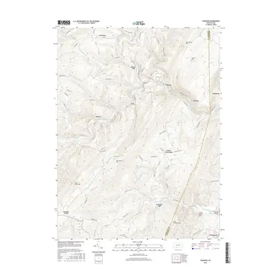
2016 Map of Fairhope
USGS Topo · Published 2016About this map
Wills Creek and its many tributaries carve through the heavy ridges of the Allegheny Front in this 2016 survey, creating a landscape defined by steep gaps and narrow valley settlements. The local economy and transportation history are anchored by water power and rail passage, evidenced by landmarks such as Bittners Mill and Kennells Mill, and the engineering of the Falls Cut Tunnel. These features indicate how early settlers and later industry adapted to the formidable barriers of Savage Mountain and Big Savage Mountain.
Find a feature on this map
75 named features on this map. Tap any name to fly to it.
Don’t see what you’re looking for? This feature index may not catch every label — zoom into the map to look around manually.
Map Details
Editions of this 2016 Fairhope Map
This is the sole edition of this map. No revisions or reprints were ever made.
Other maps of this area

1898 · Frostburg
USGS Topo · 1:62,500

1899 · Flintstone
USGS Topo · 1:62,500

1900 · Flintstone
USGS Topo · 1:62,500

1901 · Frostburg
USGS Topo · 1:62,500

1908 · Frostburg
USGS Topo · 1:62,500

1923 · Berlin
USGS Topo · 1:48,000

1927 · Hyndman
USGS Topo · 1:62,500

1929 · Berlin
USGS Topo · 1:62,500

1931 · Hyndman
USGS Topo · 1:62,500

1944 · Hyndman
USGS Topo · 1:62,500
Featured Places
- Fairhope Township, PA
- Londonderry Township, PA
- Southampton Township, PA
- Northampton Township, PA
- Kennells Mill, Southampton Township