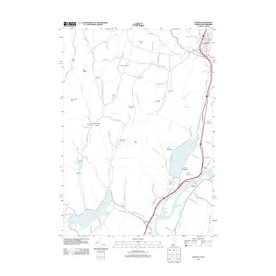
2012 Map of Fairlee
USGS Topo · Published 2012About this map
The Connecticut River serves as the primary boundary and geographical anchor for this region, separating the valley communities of Fairlee and Orford. In the early 21st century, the landscape reflects a balance of recreation and traditional New England settlement patterns. Notable recreational sites include Lake Morey and Lake Fairlee, which are surrounded by landmarks like the Bonnie Oaks Golf Course and The Palisades. The map identifies several small settlements including Bradford, Ely, and West Fairlee Center, alongside rural localities like Old Buffalo. Genealogists and local historians will find value in the density of burial sites such as the Whiting Family Cem, Kinderhood Cem, and Blood Brook School Cem. The area's complex topography is marked by named peaks like Morey Mountain, Echo Mountain, and Spaulding Hill, while the Waits River and numerous brooks illustrate the region's intricate drainage system.
Find a feature on this map
107 named features on this map. Tap any name to fly to it.
Don’t see what you’re looking for? This feature index may not catch every label — zoom into the map to look around manually.
Map Details
Editions of this 2012 Fairlee Map
This is the sole edition of this map. No revisions or reprints were ever made.
Other maps of this area

1896 · Strafford
USGS Topo · 1:62,500

1931 · Mt. Cube
USGS Topo · 1:62,500

1931 · Woodsville
USGS Topo · 1:48,000

1933 · Mt. Cube
USGS Topo · 1:62,500

1935 · Woodsville
USGS Topo · 1:62,500

1941 · Woodsville
USGS Topo · 1:62,500

1944 · Strafford
USGS Topo · 1:62,500

1947 · Corinth
USGS Topo · 1:62,500

1948 · East Barre
USGS Topo · 1:62,500

1950 · Glens Falls
USGS Topo · 1:250,000