
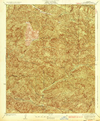
1932 Map of Fairmont
USGS Topo · Published 1932About this map
Fairmont Butte dominates the eastern horizon of this 1932 survey, marking the transition from the flat expanse of the Antelope Valley into the dissected northern reaches of the Angeles National Forest. The settlement of Fairmont serves as a small hub for the surrounding ranching and dry-farming community, supported by the Fairmont Sch nearby. Crucial infrastructure of the era is visible in the form of the Los Angeles Aqueduct, which cuts across the terrain to reach the Fairmont Reservoir, illustrating the massive engineering efforts required to move water through this arid landscape.
Find a feature on this map
26 named features on this map. Tap any name to fly to it.
Don’t see what you’re looking for? This feature index may not catch every label — zoom into the map to look around manually.
Map Details
Editions of this 1932 Fairmont Map
This is the sole edition of this map. No revisions or reprints were ever made.
Other maps of this area

1903 · Tejon
USGS Topo · 1:125,000

1915 · Elizabeth Lake
USGS Topo · 1:125,000

1917 · Elizabeth Lake
USGS Topo · 1:125,000

1931 · Warm Spring
USGS Topo · 1:24,000

1931 · Little Buttes
USGS Topo · 1:24,000

1932 · Lake
USGS Topo · 1:24,000

1932 · Hughes Lake
USGS Topo · 1:24,000

1933 · Manzana
USGS Topo · 1:24,000

1934 · Little Buttes
USGS Topo · 1:24,000
1936 · Warm Spring
USGS Topo · 1:24,000