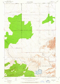
1950 Map of Fairmont
USGS Topo · Published 1950About this map
Fairmont sits at the intersection of mountain foothills and the expansive Antelope Valley floor, marking a point of transition between high desert plains and the northern reaches of the Angeles National Forest. Surveyed in 1932 with 1950 culture revisions, the map reveals a landscape defined by critical infrastructure and isolated geography. The Los Angeles Aqueduct winds through the terrain, feeding into the Fairmont Reservoir, a vital node for the region's water management. The topography is anchored by prominent landmarks such as Fairmont Butte, Antelope Buttes, and the Little Buttes, while the southern portion is deeply incised by drainages like Kings Canyon, Bleich Canyon, and Broad Canyon. A grid of rural avenues, including Avenue A and Avenue D, stretches across the valley, illustrating early agricultural and residential parceling along the Kern and Los Angeles County border.
Find a feature on this map
28 named features on this map. Tap any name to fly to it.
Don’t see what you’re looking for? This feature index may not catch every label — zoom into the map to look around manually.
Map Details
Editions of this 1950 Fairmont Map
This is the sole edition of this map. No revisions or reprints were ever made.
Other maps of this area

1903 · Tejon
USGS Topo · 1:125,000

1915 · Elizabeth Lake
USGS Topo · 1:125,000

1917 · Elizabeth Lake
USGS Topo · 1:125,000

1931 · Warm Spring
USGS Topo · 1:24,000

1931 · Little Buttes
USGS Topo · 1:24,000

1932 · Lake
USGS Topo · 1:24,000

1932 · Hughes Lake
USGS Topo · 1:24,000

1932 · Fairmont
USGS Topo · 1:24,000

1933 · Manzana
USGS Topo · 1:24,000

1934 · Little Buttes
USGS Topo · 1:24,000