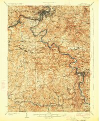
1926 Map of Fairmont
USGS Topo · Published 1926About this map
The Monongahela River and its major tributaries, the West Fork River and Valley River, anchor this 1926 industrial and rural landscape. The region is defined by the vital transportation corridor of the Baltimore and Ohio Railroad and the historic Northwestern Turnpike, which facilitated the movement of coal and timber. Intensive resource extraction is evidenced by the Tunnell Mines near Rosemont, while smaller settlements like Monongah, Thoburn, and Everson line the riverbanks.
Find a feature on this map
171 named features on this map. Tap any name to fly to it.
Don’t see what you’re looking for? This feature index may not catch every label — zoom into the map to look around manually.
Map Details
Editions of this 1926 Fairmont Map
3 editions found

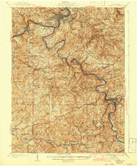
Other maps of this area

1886 · St. George
USGS Topo · 1:125,000

1891 · St. George
USGS Topo · 1:125,000

1902 · Clarksburg
USGS Topo · 1:62,500

1902 · Fairmont
USGS Topo · 1:62,500

1902 · Morgantown
USGS Topo · 1:62,500

1904 · Philippi
USGS Topo · 1:62,500

1904 · Blacksville
USGS Topo · 1:62,500

1904 · Weston
USGS Topo · 1:62,500

1905 · Mannington
USGS Topo · 1:62,500

1907 · Thornton
USGS Topo · 1:62,500