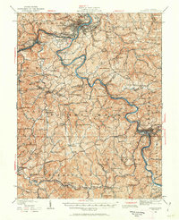
1923 Map of Fairmont
USGS Topo · Published 1962About this map
The industrial and community fabric of north-central West Virginia is preserved here, centered on Fairmont and the coal-rich valleys surrounding the Monongahela River. Steeped in the rail-and-resource economy of the early 1900s, the map reveals a landscape defined by mining operations like the Tyrconnell Mines and the critical junctions of the Baltimore and Ohio railroad. While Fairmont serves as the urban hub, the outlying districts of Booths Creek and Union are dotted with a remarkable density of rural institutions, such as the Janes Memorial Church and the Rock Union School. The transition from industrial riverfronts at Monongah and Watson to the rugged ridges of the Marion and Harrison County line illustrates the complex topography that shaped early settlement patterns, from the remote White Rock School to the river narrows at Valley Falls.
Find a feature on this map
177 named features on this map. Tap any name to fly to it.
Don’t see what you’re looking for? This feature index may not catch every label — zoom into the map to look around manually.
Map Details
Editions of this 1923 Fairmont Map
2 editions found

Other maps of this area

1886 · St. George
USGS Topo · 1:125,000

1891 · St. George
USGS Topo · 1:125,000

1902 · Clarksburg
USGS Topo · 1:62,500

1902 · Fairmont
USGS Topo · 1:62,500

1902 · Morgantown
USGS Topo · 1:62,500

1904 · Philippi
USGS Topo · 1:62,500

1904 · Blacksville
USGS Topo · 1:62,500

1904 · Weston
USGS Topo · 1:62,500

1905 · Mannington
USGS Topo · 1:62,500

1907 · Thornton
USGS Topo · 1:62,500